Muong Hoa Valley Loop
Sa Pa, Lao Cai, Vietnam
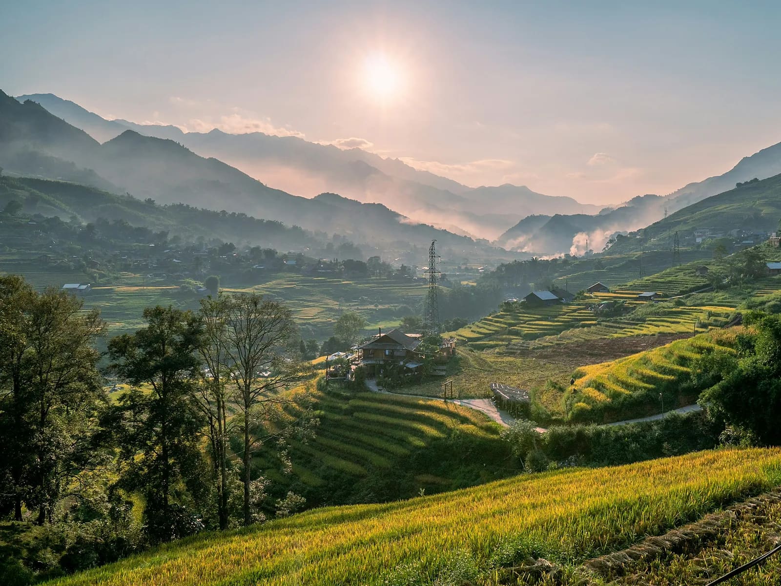
Lao Chai – Ta Van rice terraces on the actual VMM course
Overview
If you run only one route in Sa Pa, make it this one. From the town centre at 1,550 m, flagstone lanes and footpaths drop 600 m into the floor of the Muong Hoa valley, cutting through terraces ranked among the most beautiful on earth and two villages – Black H'Mong Lao Chai and Giay Ta Van. Across the suspension bridge the loop climbs the far side of the valley past a field of 2,000-year-old rock carvings before hauling back up to town. It is shared by every VMM distance, so in August–September you will meet plenty of runners training. Free, full phone coverage, stalls everywhere – the perfect introduction to north-western terrain.
- Elevation gain
- +676 m
- Elevation loss
- −671 m
- Max altitude
- 1,550 m
- Min altitude
- 933 m
- Completions
- 5
- Trail Pack owners
- 0
Route
271 GPS pointsKm 0–3.2: flagstone Muong Hoa road out of town, then a footpath down through terraces. Km 3.2–5.1: terrace steps and dirt into Lao Chai (ticket). Km 5.1–8.4: concrete village road along the stream to Ta Van. Km 8.4–11: over the suspension bridge and up the eastern side on buffalo paths to the rock carvings. Km 11–15.5: 500 m climb back to town on dirt and concrete.
Waypoints
- km 0.0Sa Pa stone churchStart1545 m
- km 3.2Muong Hoa valley lookoutViewpoint1144 m
- km 5.1Lao Chai villageVillage958 m
Black H'Mong village. 75,000 ₫ entry ticket at the gate.
- km 5.3Lao Chai groceryWater955 m
- km 6.8Muong Hoa suspension bridgeRiver crossing946 m
- km 8.4Ta Van – Giay village eateryFood1016 m
- km 11.0Sa Pa ancient rock carvingsViewpoint1227 m
- km 15.5Sa Pa stone churchFinish1550 m
Elevation
620 m down, 610 m up. Low point 940 m at Ta Van. The km 11–15.5 climb averages 11 % and is where many VMM runners blow up in the heat.
Weather
Sa Pa is wet year-round; summer brings afternoon storms, winter thick fog at 2–8 °C. The valley floor is 4–5 °C warmer than town. September is sunny but hits 28 °C at the bottom.
How to get there
Start at the stone church in central Sa Pa. From Hanoi: overnight train to Lao Cai plus a 1 h bus, or a 5.5 h limousine van. Motorbike taxis from Ta Van (80,000 ₫) if you want to cut it short.
Water sources
Stalls in every village: Lao Chai km 5.3, Ta Van km 8.4, Hau Thao km 12. One litre on you is plenty.
- km 5.3Lao Chai grocery
Food
Ta Van has many rice eateries and terrace-view cafés (60,000–120,000 ₫). Thang co stew, grilled stream fish and tao meo apple wine at Sa Pa market afterwards.
- km 8.4Ta Van – Giay village eatery
Camping
Not needed – a Ta Van homestay (150,000–300,000 ₫/person) is worth it if you split the loop over two days and run sunrise among the terraces.
Safety
Slick flagstones in rain, buffalo and motorbikes on the village road, and persistent vendors following you in Lao Chai (decline politely). Children often ask for sweets – MONT encourages not giving any, to avoid reinforcing the habit.
Emergency
Save the local contacts before you lose signal. Tell someone your route and turnaround time.
Best season
Mid-September for golden rice; May for mirror-like flooded terraces; March–April for dry trails and peach and plum blossom.
Equipment
Light trail shoes, 5 L vest, sunscreen, small notes for village tickets and food. A thin rain jacket even on a clear day.
Trail reports
No open reports. Be the first to report a condition change.
Reviews
- ATLê Anh TuấnTrail Expert10 Sept 2026
Cung chạy đẹp nhất mình từng chạy
Chạy giữa tháng 9 khi lúa chín. Đoạn leo cuối về thị trấn đúng là 'sát thủ' như mô tả. Nhiều quán nước nên không cần mang nhiều.
- THNgô Thu HuyềnTrail Explorer24 Jul 2026
Người bán hàng rong hơi nhiều
Đường và cảnh 5 sao. Trừ 1 sao vì bị theo suốt 2 km ở Lao Chải. Nên đi sớm trước 7h để tránh đoàn khách.
Sign in to leave a review.
Nearby trails
Fansipan via Tram Ton
Fansipan · Lao Cai
- Distance
- 23.1 km
- Elevation
- +1,362 m
- Time
- 10–14 h
Ta Van – Ban Ho
Sa Pa · Lao Cai
- Distance
- 12.6 km
- Elevation
- +199 m
- Time
- 4–6 h