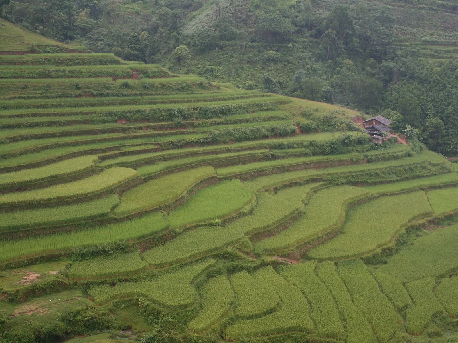
Pu Luong Traverse over the 1,700 m summit
Pu Luong, Thanh Hoa, Vietnam
From Don village terraces over Pu Luong peak down to Kho Muong
Overview
Pu Luong in a day: start in Don village among Thai rice terraces, pass Hieu village and its bamboo waterwheels, then plunge into the reserve's primary rainforest for a relentless 1,200 m climb to the Pu Luong summit. The top is forested, but the lookout just beyond opens onto the whole Kho Muong valley. A long, humid, leech-rich descent ends at the Bat Cave and the stilt houses of Kho Muong. This is the Vietnam Jungle Marathon 42K in miniature – hot, wet, steep and very green. Nothing technical, but you need solid fitness and serious leech preparation.
- Elevation gain
- +1,289 m
- Elevation loss
- −1,222 m
- Max altitude
- 1,713 m
- Min altitude
- 493 m
- Completions
- 3
- Trail Pack owners
- 5
Route
263 GPS pointsKm 0–3.8: paddy dykes and concrete through Hieu village, one ford. Km 3.8–9.7: continuous forest climb on narrow, rooty, muddy path; km 6–8 is steepest. Km 9.7–13: ridge then a slick descent through bamboo. Km 13–16.4: widening path into Kho Muong. Km 16.4–19.8: dirt and concrete out to provincial road 15C.
Waypoints
- km 0.0Don villageStart493 m
Resort area; VJM start line.
- km 2.1Hieu village waterwheelsWater658 m
- km 9.7Pu Luong summit 1,700 mSummit1604 m
Forested, no view at the top; lookout at km 10.2.
- km 16.4Kho Muong – Bat CaveVillage635 m
- km 16.6Kho Muong homestayFood626 m
- km 19.8Provincial road 15C – Pho DoanFinish561 m
- 4 premium waypoints (water, camps, hazards) are in the Trail Pack
Elevation
1,320 m up, 1,260 m down. From 500 m to 1,700 m in 6 km (20 % average). The Kho Muong descent drops 1,100 m in 7 km.
Weather
Hot and humid in the valleys year-round (32 °C in summer), 18–22 °C on the summit. Wettest June–September; the forest is damp even in the dry season. Morning fog on the ridge.
How to get there
170 km from Hanoi, 4 h by car via Mai Chau. Limousine van Hanoi – Pu Luong 250,000 ₫. From Pho Doan back to Don village is 12 km by motorbike taxi.
Water sources
Plenty of streams and waterwheels in the first half, a forest stream at km 13 (filter). The km 4–13 climb is hot with no stalls – carry 2 litres.
- km 2.1Hieu village waterwheels
Exact locations are part of the Trail Pack
Food
Don village homestays serve breakfast from 6 am. Kho Muong homestays do bamboo-tube rice, hill chicken and bamboo-shoot soup (book ahead). Carry food for 6–7 hours in the forest.
- km 16.6Kho Muong homestay
Camping
No camping inside the reserve. Stilt-house homestays in Kho Muong (150,000–250,000 ₫) or bungalows in Don village (600,000+).
Safety
Leeches are dense from km 4 to km 15 – leech socks are mandatory. Pit vipers on damp trail. Four fords that rise fast in rain. No signal in the forest km 5–14. Easy to go wrong at the km 11.3 junction – clearly marked in the Trail Pack.
Dangerous sections
- km 6–8.2Unlock the Trail Pack to read this section
- km 11–12.4Unlock the Trail Pack to read this section
Escape routes
- km 3.8Unlock the Trail Pack to read this section
- km 13Unlock the Trail Pack to read this section
Emergency
Save the local contacts before you lose signal. Tell someone your route and turnaround time.
Best season
Late September–October (ripe rice, less rain) and March–May (drier, fewer leeches). June rice is beautiful but brutally hot.
Equipment
Leech socks, draining trail shoes, 8–12 L vest with 2 litres, water filter, salt or leech repellent, rain shell, poles for the slick descent, offline GPX.
- Leech socks
- Draining trail shoes
- 8–12 L vest, 2 L water
- Water filter
- Salt or leech repellent
- Light rain shell
- Folding poles
- Dry bag
- Offline GPX + power bank
Trail reports
- Fallen treeCây lớn đổ chắn ngang lối mòn ở km 7,2, phải chui qua. Có thể vượt được nhưng mất 5 phút.Phạm Khánh Linh · 13 Sept 2026 · km 7.2 · verified by moderator
Reviews
- KLPhạm Khánh LinhTrail Expert Verified3 Aug 2026
Vắt. Rất nhiều vắt.
Tất chống vắt Hoàng Liên cứu mình. Đường lên đỉnh dốc và bùn, xuống Kho Mường trơn. Ngã ba km 11,3 đánh dấu rõ trong GPX, không có chắc lạc.
Sign in to leave a review.